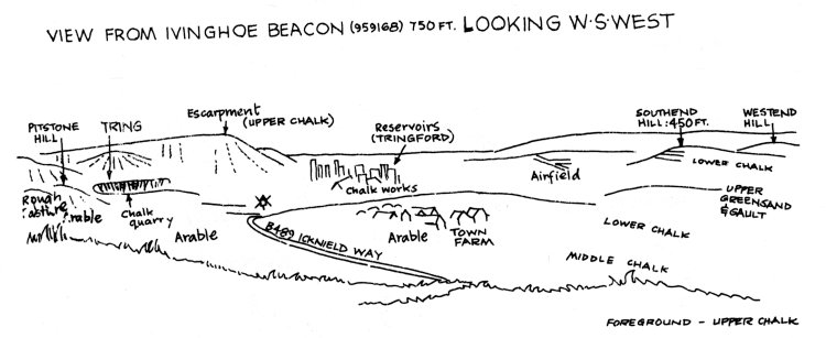
On arrival at the top of the west face of the Beacon time was taken for a slight rest, during
which we wandered round and admired the view. We noted the plinth marking the trigonometrical
point used by the Ordnance Survey and to the north-east could see a lion cut into the chalk
escarpment at Whipsnade Zoo. To the west we had a splendid view of an English early morning
(11 15 a.m.!) mist. It was remarked that although geographers cannot see through a mist, nor
disperse it, nor even draw a field-sketch of it, they are very good at telling you what causes
it! But a field-sketch was attempted, including some tall chimneys in the foreground. You may
have been informed by a television programme that these chimneys have been blown up since -
and the rumour current in geographical circles that our field sketches have been sold at great
profit as historical documents is hotly denied.
 |
Returning to the bus we set out for Tring.
G. Borgeat.